From route planning to the finished multi-stage tour – all in one tool.
🗺
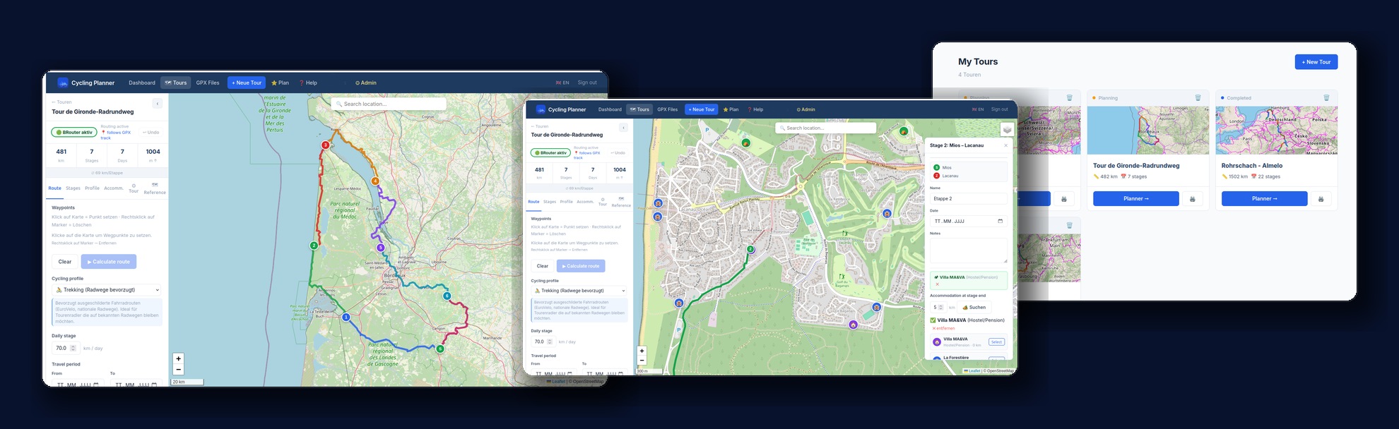
Interactive planner
Click on the map, set waypoints and BRouter automatically calculates the optimal cycling route – with 8 different profiles (Trekking, Road, Gravel, MTB…)
📍
Stage management
Move stage endpoints by drag & drop, insert or split stages. Via-points for precise routing. Undo up to 20 steps.
🔄
Circular tours – move start
Start a circular tour from any point – such as your train station. BRouter automatically calculates the approach, circular route and return journey.
Pro
⛰️
Elevation profile
Interactive elevation profile with tooltip: distance, elevation and stage info on hover. Synchronised with the map marker.
🌤
Weather forecast
Open-Meteo weather forecast for each stage – up to 16 days ahead. Temperature, rain, wind directly in the planner.
Pro
🏕
Accommodation search
Campsites, hotels, huts and hostels along the route via OpenStreetMap – directly on the map as markers.
Pro
📂
GPX import & export
Import GPX tracks, analyse (elevation correction via SRTM, difficulty, gradient) and export as GPX. Compatible with Garmin, Wahoo, Komoot.
🔗
Share tour
Generate a public link – viewable without login. Map, elevation profile and stage table for companions, family or friends.
Pro
🖨️
Print view / PDF
Print-optimised tour overview with stage table, statistics, weather and elevation profile. Save as PDF via browser print dialog.
🗺
Reference tracks
Load a second GPX track as background layer – ideal for using well-known routes like EuroVelo as orientation.
🛰️
Live tracking
Share your GPS position in real time with family and friends – no account needed on their end. Just send the link, that's it. The map shows your live location, the distance covered plus speed and elevation.
Pro
⚡
E-Bike Energy Planner
Calculate battery consumption and range per stage based on capacity, assist mode and elevation profile. Find e-bike charging stations along the route via OpenStreetMap.
Pro
🎒
Packing list
Ready-made packing list for cycling trips – customisable, with categories, weight tracking and print function. Never forget anything again.
🏆
Athletics Dashboard
Import GPX activities from Garmin, Wahoo or Strava. Fitness curve, elevation trend, HR zones and yearly statistics at a glance.
Pro
📵
Data export
Download all your tours and GPX files as a ZIP at any time. Your data belongs to you – take it with you whenever you want.
Pro